You can contact us by e-mail or phone
from uk
01405 862917
outside uk
+44 1405 862917
01405 862917
+44 1405 862917
Across Bhutan By Bike
All Meals Included
Duration
Grade
Max Altitude
Accommodation

Trip Overview
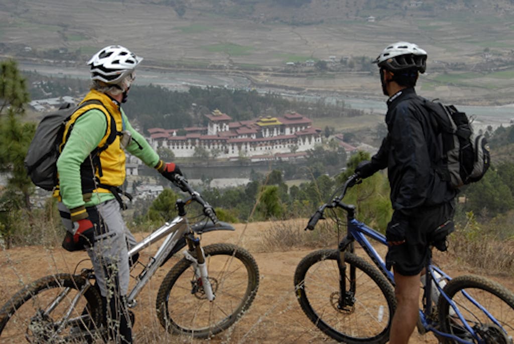
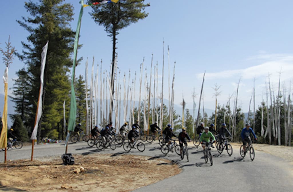
This is a very challenging Bhutan cycling holiday as you traverse Bhutan from West to east, although it can be both shortened and lengthened in duration.
But for those that love their cycling, this is a truly rewarding epic journey and, needless to say, a wonderful way of experiencing Bhutan. The “bare facts” of this trip speak for themselves and will either entice you or have you running for cover. Over 7 days of cycling, you’ll cover 620 km, involving a grand total of 11,600m of ascent and a mouth-watering 12,500m of descent. It’s the equivalent of climbing Everest on a mountain bike and then some more. A fair bit more To add to the challenge, at the altitudes this ride attains, it can get very cold, particularly on the mountain passes. Cycling beyond Bumthang, you enter a more remote but beautiful part of Bhutan where very few tourists bother to venture, meaning that after a few nights in comfortable hotels, more basic lodge accommodation and possibly a night camping are necessary. For those that dare, there is quite possibly the best afternoon’s downhill road ride in the world to enjoy: 3200 m—yes, that’s not a misprint—of downhill cycling in one go. If you love cycling, then this may be the best 5 hours you’ve ever had on a bike. Vehicle support is provided and there may be times when it will be necessary to utilise it on some of the longer cycling days if progress is slow, or if you’re just plain old pooped! For those that complete this Bhutan cycling holiday, you can be sure that you’ve just ridden one of the toughest road cycling adventures going. Of course you can’t come to Bhutan without doing the Tigers Nest hike, so that’s included too. Are you up for the Cycle Bhutan challenge?
Entry Level Front Suspension Mountain Bikes (and helmets) are provided. You are the engine!
This is a very challenging Bhutan cycling holiday as you traverse Bhutan from West to east, although it can be both shortened and lengthened in duration.
-
But for those that love their cycling, this is a truly rewarding epic journey and, needless to say, a wonderful way of experiencing Bhutan. The “bare facts” of this trip speak for themselves and will either entice you or have you running for cover. Over 7 days of cycling, you’ll cover 620 km, involving a grand total of 11,600m of ascent and a mouth-watering 12,500m of descent. It’s the equivalent of climbing Everest on a mountain bike and then some more. A fair bit more To add to the challenge, at the altitudes this ride attains, it can get very cold, particularly on the mountain passes. Cycling beyond Bumthang, you enter a more remote but beautiful part of Bhutan where very few tourists bother to venture, meaning that after a few nights in comfortable hotels, more basic lodge accommodation and possibly a night camping are necessary. For those that dare, there is quite possibly the best afternoon’s downhill road ride in the world to enjoy: 3200 m—yes, that’s not a misprint—of downhill cycling in one go. If you love cycling, then this may be the best 5 hours you’ve ever had on a bike. Vehicle support is provided and there may be times when it will be necessary to utilise it on some of the longer cycling days if progress is slow, or if you’re just plain old pooped! For those that complete this Bhutan cycling holiday, you can be sure that you’ve just ridden one of the toughest road cycling adventures going. Of course you can’t come to Bhutan without doing the Tigers Nest hike, so that’s included too. Are you up for the Cycle Bhutan challenge?
Entry Level Front Suspension Mountain Bikes (and helmets) are provided. You are the engine!
Example Itinerary
-
-
Day 1Arrive Paro. Transfer to Paro Hotel.
-
Day 2Taktsang Monastery Trek - Option to add 2 day Bumdra Trek to Taktsang.
-
Day 3Paro to Punakha via the Dochu La
-
Day 4The Black Mountains to Gangtey
-
Day 5Over the Pele La to Trongsa
-
Day 6Across the Yotung La to Bumthang
-
Day 7The Ura La & Wangthang La
-
Day 8The Thumsing La monster downhill
-
Day 9The Kori La to Trashigang
-
Day 10 - 12Return to Paro via Bumthang & Punakha
-
Day 13Depart Paro
-
-
DAY
1Arrive Paro. Transfer to Paro Hotel.
Arrive at Paro Airport. You’ll be met upon arrival and transferred by private vehicle to your hotel in the very small town of Paro. Depending on your arrival time, you may be able to enjoy a short sightseeing tour of Paro.
Accommodation: Tenzinling Hotel or similar, Paro
Meals: Dinner
For detailed information, choices and advice for International flight options to Paro, Bhutan - please click hereDAY 1
Arrive Paro. Transfer to Paro Hotel.
Arrive at Paro Airport. You’ll be met upon arrival and transferred by private vehicle to your hotel in the very small town of Paro. Depending on your arrival time, you may be able to enjoy a short sightseeing tour of Paro.
Accommodation: Tenzinling Hotel or similar, Paro
Meals: Dinner
For detailed information, choices and advice for International flight options to Paro, Bhutan - please click hereDAY
2Taktsang Monastery Trek - Option to add 2 day Bumdra Trek to Taktsang.
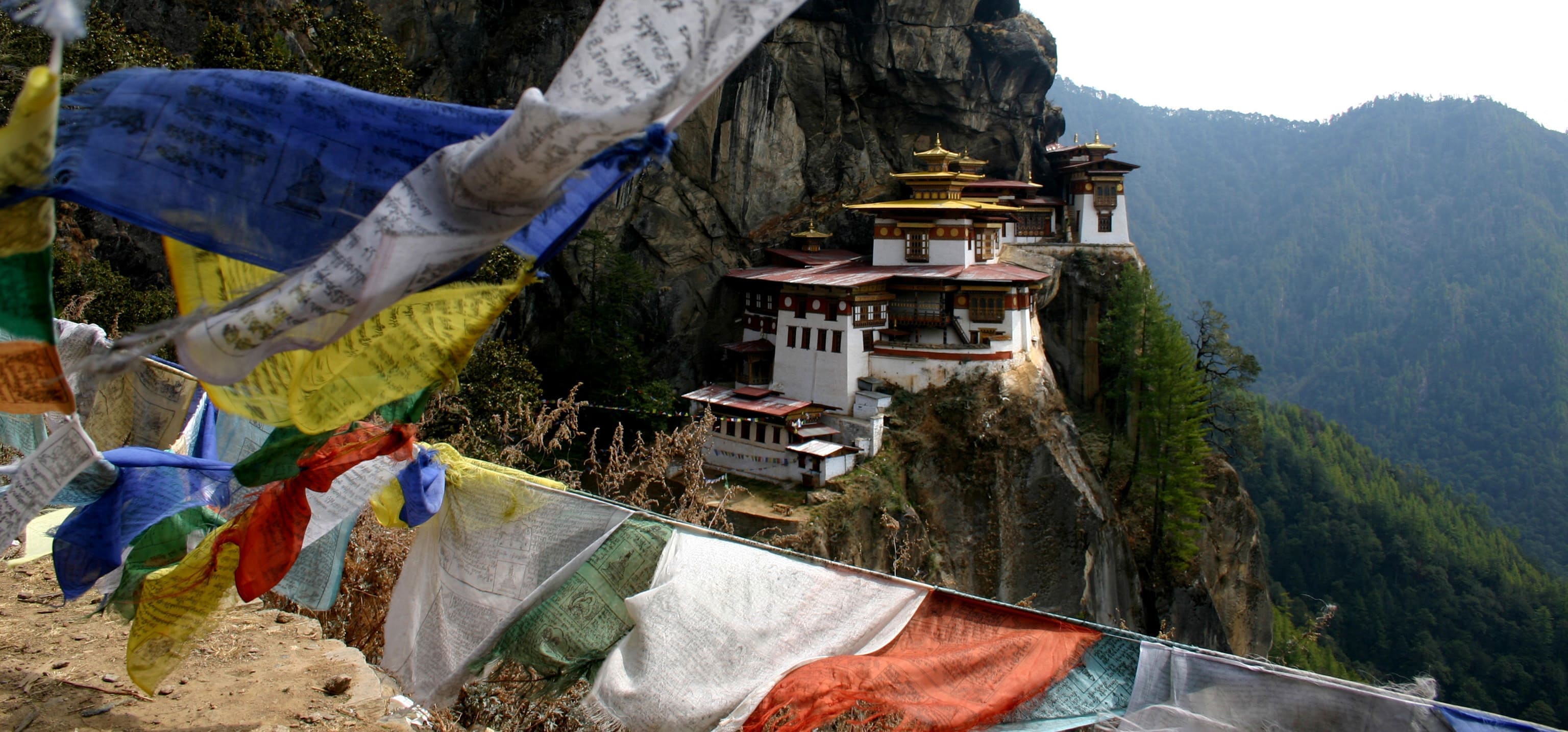
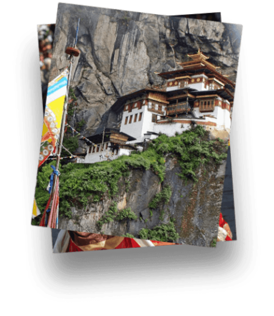
As a prelude and body stretcher for the epic Bhutan cycling adventure to come, today you’ll hike to Taktsang Monastery, the Machu Picchu of Bhutan. You can’t really come to Bhutan and not go and see it, can you? It’s actually a stiff 2-hour walk up through woodland and a rather steep climb of around 350 m. Thankfully, there’s a teahouse at one of the classic Taktsang Monastery view points where you can rest and refresh before a further 30 minutes of climbing brings you to Takstang (3110m) itself. On the final climb, you pass what is probably the most famous view point, which looks directly across to the monastery. It’s usually possible to enter the monastery, but if there’s something going on at the monastery (religious or VIP visit), then it may not be possible. Heading steeply down, a descent of around 100m leads into a gorge before climbing back up to the main monastery gate, from which it’s down to the valley floor and your ride “home”. Walking time is around 4-5 hours, with around 750m of ascent and descent. It’s actually quite a challenging walk to get your iconic photo’s of what is probably Bhutan’s most famous site.
Alternatively this can also be extended to become a 2 day trek known as the Bumdra Trek. This hike begins at Sang Choekor Monastery (2800m) near Paro followed by a steep climb of around 2hrs to a ridge and then to Chhoe Chhoe Tse Lakhang and then up through pine forests to Bumdra Monastery (3800m) where you spend the night at fixed camp. Walking time is around 4hrs total with 1000m ascent. There’s also the option to climb Bumdra Peak (2-3hrs return and approx 4000m) for greater Himalayan views.
The following day you would trek from Bumdra to Taktsang Monastery , which takes around 3hrs and then descend on the main Taktsang trail and return to Paro by private vehicle for the night.Accommodation: Hotel Tenzinling or similar, Paro
Meals: Breakfast, Lunch, DinnerDAY 2
Taktsang Monastery Trek - Option to add 2 day Bumdra Trek to Taktsang.
As a prelude and body stretcher for the epic Bhutan cycling adventure to come, today you’ll hike to Taktsang Monastery, the Machu Picchu of Bhutan. You can’t really come to Bhutan and not go and see it, can you? It’s actually a stiff 2-hour walk up through woodland and a rather steep climb of around 350 m. Thankfully, there’s a teahouse at one of the classic Taktsang Monastery view points where you can rest and refresh before a further 30 minutes of climbing brings you to Takstang (3110m) itself. On the final climb, you pass what is probably the most famous view point, which looks directly across to the monastery. It’s usually possible to enter the monastery, but if there’s something going on at the monastery (religious or VIP visit), then it may not be possible. Heading steeply down, a descent of around 100m leads into a gorge before climbing back up to the main monastery gate, from which it’s down to the valley floor and your ride “home”. Walking time is around 4-5 hours, with around 750m of ascent and descent. It’s actually quite a challenging walk to get your iconic photo’s of what is probably Bhutan’s most famous site.
Alternatively this can also be extended to become a 2 day trek known as the Bumdra Trek. This hike begins at Sang Choekor Monastery (2800m) near Paro followed by a steep climb of around 2hrs to a ridge and then to Chhoe Chhoe Tse Lakhang and then up through pine forests to Bumdra Monastery (3800m) where you spend the night at fixed camp. Walking time is around 4hrs total with 1000m ascent. There’s also the option to climb Bumdra Peak (2-3hrs return and approx 4000m) for greater Himalayan views.
The following day you would trek from Bumdra to Taktsang Monastery , which takes around 3hrs and then descend on the main Taktsang trail and return to Paro by private vehicle for the night.Accommodation: Hotel Tenzinling or similar, Paro
Meals: Breakfast, Lunch, DinnerDAY
3Paro to Punakha via the Dochu La
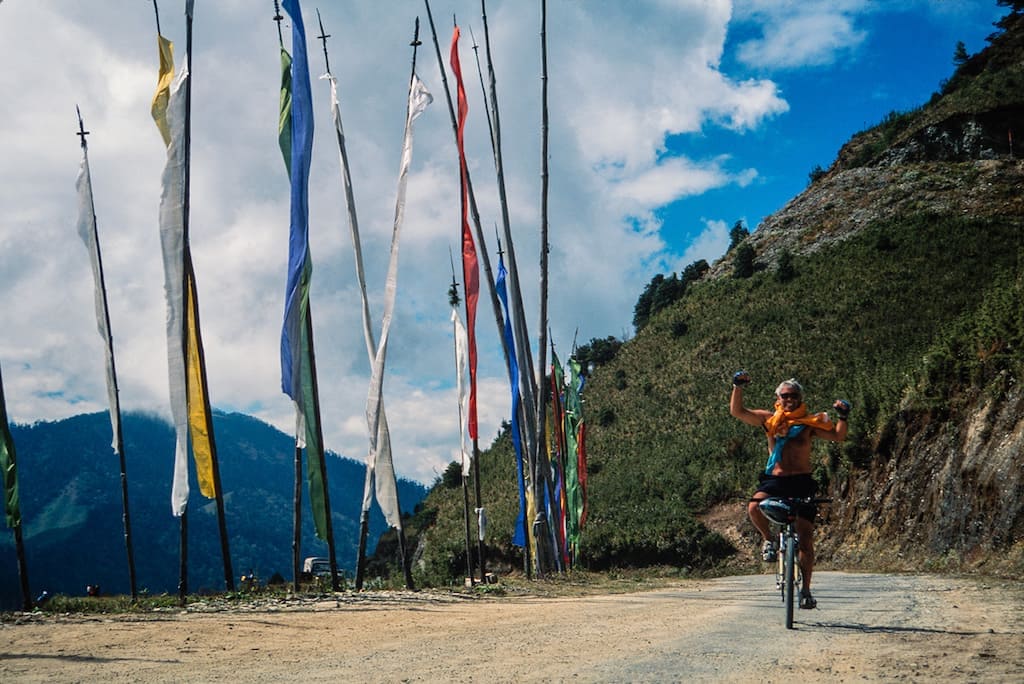
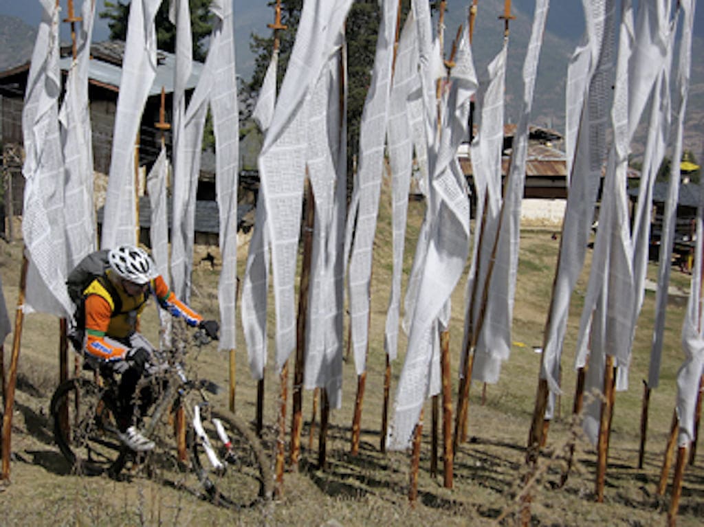
In the deep end with a tough starting day. Starting from Paro at 2400m, it’s innocent enough to begin with as you ride fairly gently to Chhuzom (2068m). But then you have to start climbing. Beyond Namseling, you will soon get your first views of Bhutan’s capital, Thimpu, but with the recent completion of the Thimpu-India Highway, the city has been bypassed, and instead you head east along the main road that links east and west Bhutan. From now on, traffic will be much less, and the next 21 km of uphill section to reach the Dochu La is a fairly steady gradient of around 4% most of the way. The bad news is that there’s around 900m of ascent to slog your way up. But it’s breathtaking too (literally); there are fantastic views down to Thimpu, and for most of the way, you’re cycling up through lush forests, with the local bird population helping you along with their song. After a few hours of huffing and puffing, the prayer flags above you indicate that you’re almost there at the pass, and hopefully your efforts are rewarded with stunning views of the Himalayas. Take a break; you’ve earned it. Now comes the fun part. Around 45km and over 2,000m of descent! Potentially, that’s a good 2-3 hours of mostly freewheeling and whizzing your way down from the Dochu La to Punakha. From the possible bitter cold of the Dochu La, you’ll get warmer and warmer as you drop down into the lush Punakha Valley. The cycling distance is approx. 120km, with around 1500 m of ascent and 2600 m of descent. On average, this is around 8–9 hours of cycling to get from Paro to Punakha.
Accommodation: Meri Phuensum Resort Hotel or similar, Punakha
Meals: Breakfast, Lunch, DinnerDAY 3
Paro to Punakha via the Dochu La
In the deep end with a tough starting day. Starting from Paro at 2400m, it’s innocent enough to begin with as you ride fairly gently to Chhuzom (2068m). But then you have to start climbing. Beyond Namseling, you will soon get your first views of Bhutan’s capital, Thimpu, but with the recent completion of the Thimpu-India Highway, the city has been bypassed, and instead you head east along the main road that links east and west Bhutan. From now on, traffic will be much less, and the next 21 km of uphill section to reach the Dochu La is a fairly steady gradient of around 4% most of the way. The bad news is that there’s around 900m of ascent to slog your way up. But it’s breathtaking too (literally); there are fantastic views down to Thimpu, and for most of the way, you’re cycling up through lush forests, with the local bird population helping you along with their song. After a few hours of huffing and puffing, the prayer flags above you indicate that you’re almost there at the pass, and hopefully your efforts are rewarded with stunning views of the Himalayas. Take a break; you’ve earned it. Now comes the fun part. Around 45km and over 2,000m of descent! Potentially, that’s a good 2-3 hours of mostly freewheeling and whizzing your way down from the Dochu La to Punakha. From the possible bitter cold of the Dochu La, you’ll get warmer and warmer as you drop down into the lush Punakha Valley. The cycling distance is approx. 120km, with around 1500 m of ascent and 2600 m of descent. On average, this is around 8–9 hours of cycling to get from Paro to Punakha.
Accommodation: Meri Phuensum Resort Hotel or similar, Punakha
Meals: Breakfast, Lunch, DinnerDAY
4The Black Mountains to Gangtey
Initially following the river valley and at the lowly altitude of around 1400m, there’s a short but stiff climb up to Wangdi to remind your limbs of yesterday's exertions before things level off and there’s 20km or so of fairly straightforward level pedalling. But you’ll be glad that you’ve got vehicle support, as a real toughie is coming. Just beyond Tikke, it all starts with a seemingly endless climb of 2000m to cross the Black Mountains. Depending on how you’re doing, it may be necessary to hop on board and utilise the vehicle support if time isn’t on your side. Probably exhausted by the ascent, it’s thankfully a descent now into the Gangtey Valley. Gangtey (3000m) is the name commonly given to the Phobjikha Valley, which lies in central Bhutan and is one of the kingdom's few glacial valleys. For several years, the cultivation of potatoes has brought a certain degree of prosperity to the local peasant farmers; however, the area is best known for the rare black-necked crane, which migrates from the Tibetan Plateau in order to avoid the extremely cold winters. If you’re here between late October and early spring, you may just see some of the revered Black-necked Cranes. The cycling distance today is approx. 75km, with 2450 m of ascent and 720 m of descent. Cycling time: 7-8 hrs.
Accommodation: Dewachen Hotel or similar, Gangtey
Meals: Breakfast, Lunch, DinnerDAY 4
The Black Mountains to Gangtey
Initially following the river valley and at the lowly altitude of around 1400m, there’s a short but stiff climb up to Wangdi to remind your limbs of yesterday's exertions before things level off and there’s 20km or so of fairly straightforward level pedalling. But you’ll be glad that you’ve got vehicle support, as a real toughie is coming. Just beyond Tikke, it all starts with a seemingly endless climb of 2000m to cross the Black Mountains. Depending on how you’re doing, it may be necessary to hop on board and utilise the vehicle support if time isn’t on your side. Probably exhausted by the ascent, it’s thankfully a descent now into the Gangtey Valley. Gangtey (3000m) is the name commonly given to the Phobjikha Valley, which lies in central Bhutan and is one of the kingdom's few glacial valleys. For several years, the cultivation of potatoes has brought a certain degree of prosperity to the local peasant farmers; however, the area is best known for the rare black-necked crane, which migrates from the Tibetan Plateau in order to avoid the extremely cold winters. If you’re here between late October and early spring, you may just see some of the revered Black-necked Cranes. The cycling distance today is approx. 75km, with 2450 m of ascent and 720 m of descent. Cycling time: 7-8 hrs.
Accommodation: Dewachen Hotel or similar, Gangtey
Meals: Breakfast, Lunch, DinnerDAY
5Over the Pele La to Trongsa
It’s probably best to utilise the vehicle support and be driven back up to the pass, as it means you will have a little time to spend at the Black-necked Crane Visitor Centre. Now there’s the climb as the road rises up through forests to the Pele La (3420m). There are great views of the Himalayas from here, and if it’s clear, you might be able to spot distant Chomolhari, the second highest peak in Bhutan (7219m). The pass, which can at times have a covering of snow, is of course a long, hard climb, but it also forms the boundary between Central and West Bhutan, and a change in landscape may be noticeable. It can be bitterly cold up here, as well as during the descent of almost 60km to Trongsa. You might just want to pedal some of the 1500-metre descent just to keep warm. A bridge crossing by Nikkarchu marks the entry into the Trongsa area, and the road high above the Mangde Chhu River is spectacularly “chiselled” out of the almost sheer cliff wall. The magnificent Trongsa Dzong comes into view, but it’s still 30km away, and there’s a final sting in the tail with a 300-metre ascent up to Trongsa (2200m). The distance cycled today is around 78 km, with an 800m ascent and a 1700m descent. Cycling time: 5–6 hrs.
Accommodation: Raven Crown Resort or similar, Trongsa
Meals: Breakfast, Lunch, DinnerDAY 5
Over the Pele La to Trongsa
It’s probably best to utilise the vehicle support and be driven back up to the pass, as it means you will have a little time to spend at the Black-necked Crane Visitor Centre. Now there’s the climb as the road rises up through forests to the Pele La (3420m). There are great views of the Himalayas from here, and if it’s clear, you might be able to spot distant Chomolhari, the second highest peak in Bhutan (7219m). The pass, which can at times have a covering of snow, is of course a long, hard climb, but it also forms the boundary between Central and West Bhutan, and a change in landscape may be noticeable. It can be bitterly cold up here, as well as during the descent of almost 60km to Trongsa. You might just want to pedal some of the 1500-metre descent just to keep warm. A bridge crossing by Nikkarchu marks the entry into the Trongsa area, and the road high above the Mangde Chhu River is spectacularly “chiselled” out of the almost sheer cliff wall. The magnificent Trongsa Dzong comes into view, but it’s still 30km away, and there’s a final sting in the tail with a 300-metre ascent up to Trongsa (2200m). The distance cycled today is around 78 km, with an 800m ascent and a 1700m descent. Cycling time: 5–6 hrs.
Accommodation: Raven Crown Resort or similar, Trongsa
Meals: Breakfast, Lunch, DinnerDAY
6Across the Yotung La to Bumthang
Another day and another high mountain pass to negotiate. This time, the 3400-metre Yotung La There are lots of switchbacks as you pedal up and up for around 30 km, with increasingly splendid views, to reach the pass. It's time for a descent, all the way down to 2600m and into the relative warmth of the scenic Bumthang Valley. There’s one more climb to come, though, but in comparison, it’s relatively brief, and then you can enjoy a truly exhilarating descent to Jakhar (2600m), home to another magnificent Dzong. Distance cycled was approx. 70km with around 1695 m of ascent and 1200 m of descent. Cycling time is around 7 hours.
Accommodation: Wangdichholing Lodge or similar, Jakhar
Meals: Breakfast, Lunch, DinnerDAY 6
Across the Yotung La to Bumthang
Another day and another high mountain pass to negotiate. This time, the 3400-metre Yotung La There are lots of switchbacks as you pedal up and up for around 30 km, with increasingly splendid views, to reach the pass. It's time for a descent, all the way down to 2600m and into the relative warmth of the scenic Bumthang Valley. There’s one more climb to come, though, but in comparison, it’s relatively brief, and then you can enjoy a truly exhilarating descent to Jakhar (2600m), home to another magnificent Dzong. Distance cycled was approx. 70km with around 1695 m of ascent and 1200 m of descent. Cycling time is around 7 hours.
Accommodation: Wangdichholing Lodge or similar, Jakhar
Meals: Breakfast, Lunch, DinnerDAY
7The Ura La & Wangthang La
Bumthang is about as far east as most tourists come when they visit Bhutan, so it is necessary to camp one night along the way, and then on there are only basic lodges available. But it also means that you’ll feel at times like you're the only person on the road. A passing vehicle may just be an event! It’s not getting any easier on the bikes, though. The first pass requires an ascent of 900m over 40km, followed by a looping descent to the village of Ura and an ideal lunch stop. A further 25km of cycling up and over the Wangthang La leads to about the only level place in the valley. For this particular day, a paucity of accommodation in this area may mean a night of default camping or a vehicle transfer to the nearest basic lodge. As you're now in a relatively undeveloped part of Bhutan, your accommodation arrangements will depend on the most recent developments, which we would advise you of in advance. The distance cycled today is just under 77 km, with around 1800 m of ascent and 850 m of descent. Cycling time: 7-8 hours,
Accommodation: Basic Lodge/Camp, Wanghtang Valley
Meals: Breakfast, Lunch, DinnerDAY 7
The Ura La & Wangthang La
Bumthang is about as far east as most tourists come when they visit Bhutan, so it is necessary to camp one night along the way, and then on there are only basic lodges available. But it also means that you’ll feel at times like you're the only person on the road. A passing vehicle may just be an event! It’s not getting any easier on the bikes, though. The first pass requires an ascent of 900m over 40km, followed by a looping descent to the village of Ura and an ideal lunch stop. A further 25km of cycling up and over the Wangthang La leads to about the only level place in the valley. For this particular day, a paucity of accommodation in this area may mean a night of default camping or a vehicle transfer to the nearest basic lodge. As you're now in a relatively undeveloped part of Bhutan, your accommodation arrangements will depend on the most recent developments, which we would advise you of in advance. The distance cycled today is just under 77 km, with around 1800 m of ascent and 850 m of descent. Cycling time: 7-8 hours,
Accommodation: Basic Lodge/Camp, Wanghtang Valley
Meals: Breakfast, Lunch, DinnerDAY
8The Thumsing La monster downhill
To cycle the whole journey today requires a very, very early start, just after the sun has risen. There’s a little bit of downhill, but you’re soon climbing again for almost 10 kilometres to reach the 3800-metre Thumsing La. Thankfully, it’s fairly gradual, the surrounding landscapes are mind-blowing, and you’ve probably got it all to yourself. Again, it is likely to be bitterly cold at the top, and anyway, you’re about to enjoy what could well be the best downhill ride on a road in the world. It’s that combination of totally stunning, beautiful scenery and 3200 m—yes, that’s not a misprint—of downhill cycling as you wheel your way down, down, down to just 590m. This truly wonderful downhill is spread over 85km, going from the alpine zone at the pass to a sub-tropical zone and hopefully with a bit of warmth, which on this trip is quite a rarity. As if you needed further exhilaration, the road itself becomes the star of the show (some would say scary) between Sengor and Namiling, with a massive, vertical drop from where the road has been hewn out of the mountainside. With around 5 hours of downhilling to enjoy and a bit of warmth at the lunch stop at Lingmithang (600m), this could be the best cycling day of your life. Hopefully the 20-kilometre ride up to Mongar (1600m) won’t spoil it. Cycling distance: 110km, with around 1675 m of ascent and 3500 m of descent. Cycling time is around 8 hours.
Accommodation: Basic Lodge, Mongar
Meals: Breakfast, Lunch, DinnerDAY 8
The Thumsing La monster downhill
To cycle the whole journey today requires a very, very early start, just after the sun has risen. There’s a little bit of downhill, but you’re soon climbing again for almost 10 kilometres to reach the 3800-metre Thumsing La. Thankfully, it’s fairly gradual, the surrounding landscapes are mind-blowing, and you’ve probably got it all to yourself. Again, it is likely to be bitterly cold at the top, and anyway, you’re about to enjoy what could well be the best downhill ride on a road in the world. It’s that combination of totally stunning, beautiful scenery and 3200 m—yes, that’s not a misprint—of downhill cycling as you wheel your way down, down, down to just 590m. This truly wonderful downhill is spread over 85km, going from the alpine zone at the pass to a sub-tropical zone and hopefully with a bit of warmth, which on this trip is quite a rarity. As if you needed further exhilaration, the road itself becomes the star of the show (some would say scary) between Sengor and Namiling, with a massive, vertical drop from where the road has been hewn out of the mountainside. With around 5 hours of downhilling to enjoy and a bit of warmth at the lunch stop at Lingmithang (600m), this could be the best cycling day of your life. Hopefully the 20-kilometre ride up to Mongar (1600m) won’t spoil it. Cycling distance: 110km, with around 1675 m of ascent and 3500 m of descent. Cycling time is around 8 hours.
Accommodation: Basic Lodge, Mongar
Meals: Breakfast, Lunch, DinnerDAY
9The Kori La to Trashigang
Your final day of cycling across Bhutan from west to east does feature another wonderful downhill, but you’ve got to earn it first, and that means a 20-kilometre climb up to the Kori La (2450m). It’s then a fast descent and the wonderful (maybe annoying after a while) hairpin bends at Yadi (1500m). These seem to go on forever as you drop down via bend after bend for about 30km to the Sheri Chuu River (600m). Still, you’ve just had an 1800-metre descent; life’s not so bad, eh? But, as you’ve now learned the hard way, cycling in Bhutan is never easy, and there’s a stiff climb for the final 10km up to Trashigang (1100m). Once again, accommodations are limited, so a basic lodge is as good as it gets. Distance cycled today was around 90km with approx. 1700 m of ascent and 2210m of descent. Cycling time is around 7 hours.
Accommodation: Basic Lodge, Trashigang
Meals: Breakfast, Lunch, DinnerDAY 9
The Kori La to Trashigang
Your final day of cycling across Bhutan from west to east does feature another wonderful downhill, but you’ve got to earn it first, and that means a 20-kilometre climb up to the Kori La (2450m). It’s then a fast descent and the wonderful (maybe annoying after a while) hairpin bends at Yadi (1500m). These seem to go on forever as you drop down via bend after bend for about 30km to the Sheri Chuu River (600m). Still, you’ve just had an 1800-metre descent; life’s not so bad, eh? But, as you’ve now learned the hard way, cycling in Bhutan is never easy, and there’s a stiff climb for the final 10km up to Trashigang (1100m). Once again, accommodations are limited, so a basic lodge is as good as it gets. Distance cycled today was around 90km with approx. 1700 m of ascent and 2210m of descent. Cycling time is around 7 hours.
Accommodation: Basic Lodge, Trashigang
Meals: Breakfast, Lunch, DinnerDAY
10 - 12Return to Paro via Bumthang & Punakha
At some point in the future, it is likely that the airstrip at Yongphulla, just a short distance from Trashigang, will be open for commercial flights between Trashigang and Paro. This will mean a 45-minute return flight to Paro. In the meantime, the only way back to Paro is by road. The one you’ve just cycled. But do please ask us for a status update on Trashigang-Paro flights as work is underway. So, you’ll return to Paro overland by private vehicle with overnight halts in Bumthang and Punakha, meaning two drives of around 8–10 hours and one final one of around four hours. Although if you prefer shorter drives, as this is a tailor-made holiday, we can readily add in some extra nights elsewhere on this journey. One other tailor-made alternative is to actually keep cycling and head south from Trashigang to the Indian border. It would be two more days of cycling to the border post at Samdrup Jongkhar via Wamrong. After a night in Samdrup Jongkhar, you’d then be driven to Gauhati Airport in India (approximately 3 hours away), from where there are daily flights to Delhi. If this option is of interest, please let us know.
Accommodation: Hotels in Jakhar, Punakha and Paro
Meals: Breakfast, Lunch, DinnerDAY 10
Return to Paro via Bumthang & Punakha
At some point in the future, it is likely that the airstrip at Yongphulla, just a short distance from Trashigang, will be open for commercial flights between Trashigang and Paro. This will mean a 45-minute return flight to Paro. In the meantime, the only way back to Paro is by road. The one you’ve just cycled. But do please ask us for a status update on Trashigang-Paro flights as work is underway. So, you’ll return to Paro overland by private vehicle with overnight halts in Bumthang and Punakha, meaning two drives of around 8–10 hours and one final one of around four hours. Although if you prefer shorter drives, as this is a tailor-made holiday, we can readily add in some extra nights elsewhere on this journey. One other tailor-made alternative is to actually keep cycling and head south from Trashigang to the Indian border. It would be two more days of cycling to the border post at Samdrup Jongkhar via Wamrong. After a night in Samdrup Jongkhar, you’d then be driven to Gauhati Airport in India (approximately 3 hours away), from where there are daily flights to Delhi. If this option is of interest, please let us know.
Accommodation: Hotels in Jakhar, Punakha and Paro
Meals: Breakfast, Lunch, DinnerDAY
13Depart Paro
A private vehicle transfer to Paro Airport for your departing flight.
Meals: Breakfast
Of course, there's no reason to depart today; your Bhutan holiday can be readily tailored.DAY 11
Depart Paro
A private vehicle transfer to Paro Airport for your departing flight.
Meals: Breakfast
Of course, there's no reason to depart today; your Bhutan holiday can be readily tailored.IMPORTANT
This is an EXAMPLE ITINERARY and can be customised for you accordingly.
Please consider whether you want your customisable, private trip itinerary to also include CONTINGENCY.
See our ABOUT CONTINGENCY Information
Please CONTACT US to discuss CONTINGENCY and ADDITIONAL ACCLIMATISATION, as well as other CUSTOMISATION POSSIBILITES for your PRIVATE CUSTOM TREK
Price Guide
- $ US 2995
IMPORTANT INFO ABOUT OUR PRICE GUIDES
Prices include the compulsory Bhutan Sustainable Development Fee.
For more, see: BHUTAN TOURIST CHARGES EXPLAINED
What's included
The price shown is for guideline purposes. The price is inclusive of the DAILY SUSTAINABLE DEVELOPMENT FEE, all accommodations described in the detailed itinerary (twin share in hotels) - An English-speaking Bhutanese Guide
All camping equipment (except sleeping bags) for the default camping night Tents on a twin-share basis
Private airport transfers
All road transport by private vehicles or vehicle support whilst cycling
Entry-Level Front Suspension Mountain Bike and Helmet
Good standard hotel accommodation in main towns on twin-share basis and basic lodges on a “best available” basis where tourist hotels do not exist
Bhutan Visa, Tourist and Bhutan airport taxes
All meals as indicated
B=Breakfast, L=Lunch, and D=Dinner
Don't Forget
We can customise
all our trips.
extend. shorten. upgrade
Read our Bhutan Travel Guide

All rights reserved. Snow Cat Travel is a Registered Trade Mark UK 00003289264

